

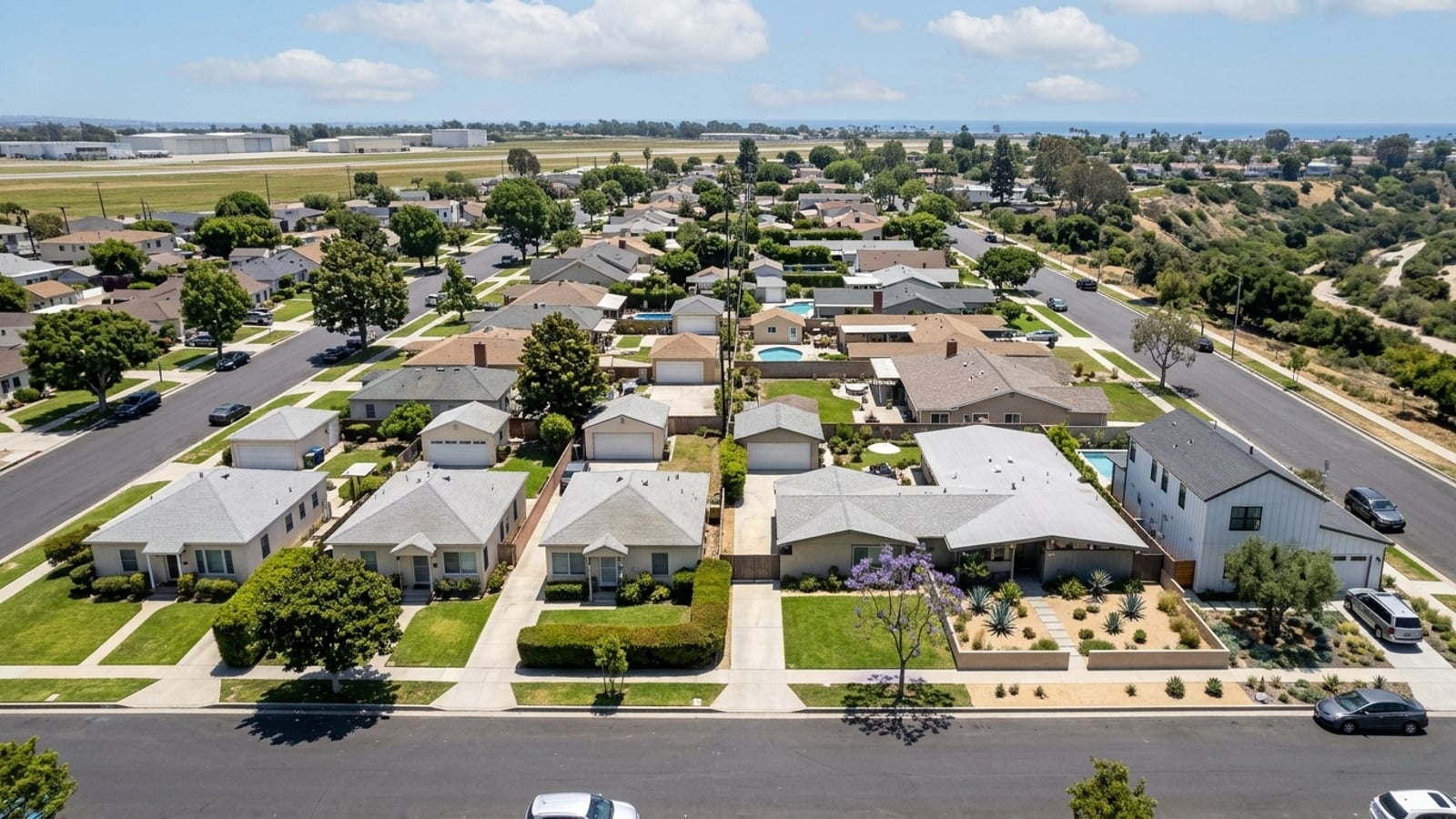
The Westchester-Playa del Rey community plan area has 64,448 residents and sits directly against the fence line of Los Angeles International Airport (LAX). That location changes what due diligence looks like here. An accurate property evaluation requires looking past the standard property-line checklist to understand how airport operations and city infrastructure shape daily life on a specific street.
When buyers ask whether Westchester is safe, the honest answer is that the question only gets useful once you're looking at address-level records, not neighborhood generalizations. Aircraft noise contours, state-mapped hazard zones, LAPD crime data, the whole picture is public and specific to individual parcels. You just have to know where to look.
Key Takeaway
Westchester has no official safety rating, so the most useful answers come from LAPD crime data, read with LAX next door in mind, alongside state hazard zones and LAX aircraft noise maps. Single-family homes are selling in a median 33 days, which usually leaves time to run those checks before you offer. If a home is drawing multiple bids, you should build these checks into your contingency period instead.
Who This Guide Is For
You are weighing an offer on a home in Westchester and want to know what official crime, hazard, and airport-noise records show before you commit.
What the Official Data Shows About Safety in Westchester
The safety questions that matter here are address-level and official: LAPD crime data read with LAX in mind, state hazard-zone disclosures, and airport-noise contours. The market usually gives you enough time to check them. Single-family homes sell in a median 33 days with 3.1 months of supply. For homes drawing real competition, those checks belong inside your contingencies rather than before them.
Westchester is a neighborhood within the City of Los Angeles, which means city services and the LAPD handle local law enforcement. The LAPD's Pacific Community Police Station covers a 25.74-square-mile area that includes Westchester, alongside Del Rey, Venice, and Playa Vista. Crime data tools update their reporting categories and timeframes regularly, so the most reliable move is pulling the specific address on LAPD's crime data tools or CrimeMapping.com for the past 12 months.
Broad labels don't tell you much. Official records for the immediate surroundings do. You can read more about the area's layout and amenities in the Westchester neighborhood overview.
Questions to Narrow Your Safety Checks
Comparing Westchester with other parts of Los Angeles? Start with the crime rate and trends section below. It explains how LAX can skew local numbers and how the neighborhood sits relative to citywide figures.
Aircraft noise a dealbreaker? Read the LAX aircraft noise and air quality section first, then look up the address on the LAX noise contour map before you schedule a tour.
Need insurance quotes, or concerned about earthquakes and flooding? The natural hazards section covers the official maps to check and the disclosure to request from the seller.
Already seeing multiple offers on the home you want? Skip to the pre-offer checks section to sort out what to finish now and what to protect with contingencies.
Westchester Crime Rate and Trends
LAPD does not publish a standalone, continuous neighborhood-level crime trend specifically for Westchester covering the 2021 to 2025 period. Citywide, the LAPD's 2025 Annual Crime Data Report shows a 19% decrease in homicides in 2025 compared to 2024, the lowest homicide count since 1966. Because LAPD transitioned its records system to new standards in March 2024, historic neighborhood-level comparability was disrupted. Current address-level searches are the most accurate way to review recent incidents.
There's one number you need to be careful about when reading Westchester's crime figures: the airport. The Los Angeles World Airports (LAWA) Airport Police Division is a separate agency, but the LAPD is the primary agency for reporting and investigating crime at LAX. Airport Police submit all crime reports to the LAPD, so citywide crime statistics accurately reflect incidents on LAWA properties.
Because LAX falls within Westchester's boundaries, airport incidents can lift the neighborhood's overall per-resident crime rate for reasons that have nothing to do with residential streets. If a data tool allows it, compare the figures with and without the airport. Third-party sites like CrimeGrade or NeighborhoodScout use their own proprietary methods to aggregate rates, which often differ from direct LAPD reports, so treat those numbers accordingly.
Police, Fire and Emergency Services in Westchester
The LAPD Pacific Division handles emergency response and neighborhood patrols for Westchester. The non-emergency reporting line is 877-ASK-LAPD. The division assigns a Senior Lead Officer to specific reporting districts to handle chronic issues and coordinate with residents directly.
The current Senior Lead Officer for Basic Car 14A73, covering Westchester and Playa del Rey, is Officer Sophie Castaneda. Fire and medical emergencies are handled by the Los Angeles Fire Department. LAFD Fire Station 5 on Emerson Avenue, Fire Station 51 on Sepulveda Boulevard, and Fire Station 95 on International Road all serve the neighborhood.
If you want to understand how policing works on a specific block, find the LAPD Senior Lead Officer for that address and ask about recent community meetings or active neighborhood watch programs. Raw data can't tell you that.
Natural Hazards in Westchester
California requires sellers to provide a Natural Hazard Disclosure (NHD) report during escrow, but you shouldn't wait for escrow to find out what zone a home sits in. The California Geological Survey maps earthquake fault zones, liquefaction zones, landslide risks, and tsunami hazard areas. FEMA maps cover flood zone status, and CAL FIRE maps cover fire hazard severity zones.
Hazard status has a direct effect on what you'll pay to own the place. A home in a FEMA-designated flood zone will trigger a lender requirement to carry flood insurance. A home in a mapped liquefaction or fault zone may carry different earthquake insurance premiums than one a few streets over.
The formal NHD report typically arrives after your offer is accepted. Check the public maps for the address before you offer, ask the seller or listing agent when the NHD will be provided, and get homeowners and earthquake insurance quotes from your agent based on the hazard-zone status before you remove contingencies.
LAX Aircraft Noise and Air Quality
Proximity to a major international airport brings specific environmental factors that vary block by block. The Federal Aviation Administration maps noise exposure, and homes within the 65 dB Community Noise Equivalent Level (CNEL) contour experience the most significant aircraft noise. Los Angeles World Airports (LAWA) previously ran a Residential Soundproofing Program that insulated over 7,300 homes in Westchester and Playa del Rey, and a newer program has since relaunched for eligible homes built before October 1998.
Air quality is a separate consideration tied to airport proximity. Air monitoring studies conducted by the South Coast Air Quality Management District and university researchers found that aircraft and ground operations at LAX influence air quality in nearby communities. Ultrafine particle concentrations are higher near runways during aircraft operations.
Visit the home during morning and evening peak flight times, windows open and closed, before you decide. Ask the seller whether the home was soundproofed through LAWA's Residential Soundproofing Program. Ask the title company whether an avigation easement or airport-related disclosure is recorded on the property, since those legally acknowledge the airport's impact on the parcel.
How to Check a Westchester Home Before You Make an Offer
A Westchester property check follows a specific order of operations. Pull LAPD crime data for the address's immediate surroundings first, filtering out LAX incidents if the tool allows. Check the state and federal hazard maps next: earthquake, fire, and flood zones. Then look up the LAX noise contour map and visit the property during peak flight hours. Know what to request in escrow before you get there: the Natural Hazard Disclosure report, the seller's property questionnaire, and the preliminary title report.
The market shapes how much time you have. A typical listing allows time for pre-offer checks. A home drawing multiple bids may not, so keep your inspection and disclosure-review contingencies in place rather than waiving them.
Buyers open to different property styles may have more breathing room. Across all home types, 35.7% sold above list, so a non-detached home might give you more time to work through due diligence without the same pressure. If you need help reviewing disclosures and structuring your timeline, Charles Fisher can help you manage the buying process in Westchester.
Westchester Housing Market at a Glance
The figures below show approximate recent market activity for the neighborhood.
- Median sale price: $1,686,028 for all homes (+5.4% year over year) and $1,769,706 for single-family homes (+2.7% year over year), 90 days ending Sept. 30, 2026
- Median price per square foot: $887 for all homes and $935 for single-family homes, 90 days ending Sept. 30, 2026
- Homes sold: 68 (all homes) and 54 (single family), 90 days ending Sept. 30, 2026
- Median days on market: 37 for all homes and 33 for single-family homes, 90 days ending Sept. 30, 2026
- Sale-to-list ratio: 100.1% for all homes and 100.5% for single-family homes, 90 days ending Sept. 30, 2026
- Share sold above list price: 35.7% of all homes and 43.3% of single-family homes, 90 days ending Sept. 30, 2026
- Months of supply: 3.6 for all homes and 3.1 for single-family homes, 90 days ending Sept. 30, 2026
- Active inventory: 80 homes (all types) and 54 single-family homes, 90 days ending Sept. 30, 2026
For more on property values, check the Westchester housing market trends, or review the guide on selling a home in Westchester if you're weighing a sale.
What Living in Westchester Is Like
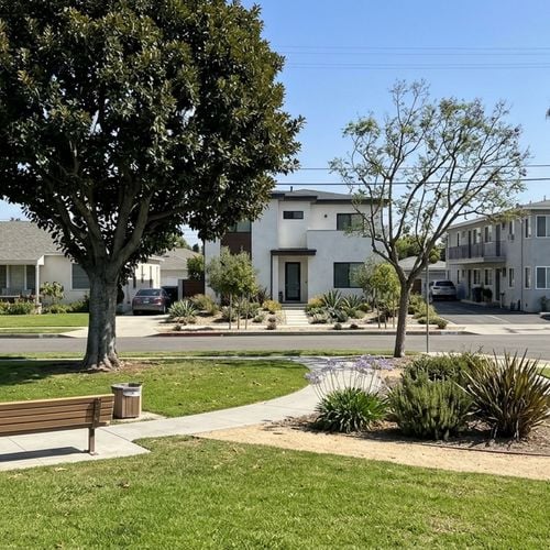
Westchester has wide residential streets, established parks, and immediate access to both the Pacific coast and major employment centers. The housing stock runs from mid-century single-family homes to newer developments closer to Playa Vista. The trade-off residents make is a known one: airport noise and traffic in exchange for proximity to the beach and a relatively short commute to a lot of places. You can find local activities on our list of things to do in Westchester.
Always confirm the assigned public school with LAUSD's school locator. Don't rely on what a listing says. You can read more about daily life on the pros and cons of living in Westchester page. When you're ready to look at properties, reach out to a real estate agent in Westchester.
Westchester, Los Angeles FAQs
Is Westchester a City or Part of Los Angeles?
Westchester is a neighborhood within the City of Los Angeles. It falls within Los Angeles City Council District 11, currently represented by Traci Park. Because it's part of the city, residents rely on Los Angeles municipal services and the LAPD.
Where Is the Westchester Neighborhood in Los Angeles?
Westchester sits in the western region of Los Angeles, directly north of LAX. It's bounded roughly by La Cienega Boulevard and the Inglewood city line on the north and east, the El Segundo boundary or Imperial Highway on the south, and Pershing Drive and Westchester Parkway on the west.
What Cities Are Close to Westchester, CA?
Westchester borders several independent cities and Los Angeles neighborhoods. It sits immediately north of El Segundo, west of Inglewood, and east of Playa del Rey and the Pacific Ocean. Playa Vista borders the neighborhood to the northwest.
Is Westchester Part of West LA?
Westchester is located in the western region of Los Angeles, but West Los Angeles is a distinct, separate neighborhood further north. Westchester is typically grouped into the Westside region by city planning maps and falls under the LAPD's West Bureau.
How Far Is Westchester From Downtown Los Angeles?
Westchester is located southwest of downtown Los Angeles. Third-party distance calculators estimate the drive at roughly 12 to 20 miles depending on the route. Commute times vary based on traffic along I-405 and I-10.
Is Westchester a Nice Part of LA?
Westchester offers immediate access to the coast, established parks, and a mix of mid-century and newer housing. The main trade-off is proximity to LAX, which brings varying levels of aircraft noise and traffic depending on the specific street.
Is Westchester, Los Angeles Expensive?
Property values in the neighborhood reflect its coastal proximity and Los Angeles location. Recently, the median sale price for all homes in Westchester was $1,686,028, up 5.4% year over year for the 90 days ending September 30, 2026.
What Is the Property Tax Rate in Westchester, Los Angeles?
Real property in Westchester is subject to California's Proposition 13 framework, which restricts the base tax rate to 1% of the assessed value. Voter-approved local debt can push the total rate slightly higher, though it generally does not exceed 1.25% in Los Angeles County. Ask the LA County Assessor or Auditor-Controller for the property's specific tax rate area and any direct assessments on the bill.
Sources
- City of Los Angeles Department of City Planning: Westchester-Playa del Rey Community Profile
- LAPD: Pacific Community Police Station
- City of Los Angeles: LAPD 2025 Crime Data Report
- LA Board of Police Commissioners: LAPD/LAWA Memorandum of Agreement
- Los Angeles City Council District 11: Westchester
- Los Angeles World Airports: Residential Sound Insulation Program
- California Air Resources Board: LAX Air Quality Study
- City of Los Angeles Department of City Planning: Maps
- Los Angeles County Auditor-Controller: 2024-2025 Taxpayers' Guide
- Redfin: Data Center
Check out this article next